Crown Lands is investigating the removal of the dam and rehabilitation of the land to a near-natural state.
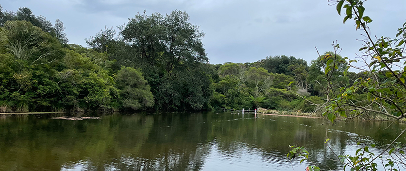
The Burwood Colliery Dam was constructed in the late 1800s in Whitebridge, Lake Macquarie. It is just west of the Fernleigh walking and cycling track, near Whitebridge High School.
Burwood Colliery Dam no longer operates as a water supply dam. The dam currently acts as part of the local stormwater system, reducing the concentration and speed of stormwater flows. This means sediment in the stormwater is deposited into the dam.
It is likely the dam will eventually silt up and become swampy land, like an artificial seasonal wetland.
Major and costly repairs would be required to extend the life of dam structures, including the wall and spillway.
Ongoing maintenance and monitoring would also be required to avoid dam failure which, if occurred, could result in environmental damage.
As the spillway was unguarded and could be accessed by the public, Crown Lands has installed safety barriers to improve public safety.
Summary

Location
Whitebridge, Lake Macquarie

Dates
2022 – Ongoing

Project status
In progress

Type of activity
Proposed removal of dam and rehabilitation of land to a near-natural state

Community consultation status
Phase 1 complete, further consultation planned as project progresses
Key points
- We are currently undertaking detailed site investigations to better understand the condition of the dam.
- These investigations will inform the future management of the site.
- We will consult with the community again on any future plans about the dam and keep you updated as the project progresses.
Impacts
While we appreciate that the dam wall and spillway are used for access to and from Lonus Avenue, the safety issue cannot be ignored.
To address the safety risk, we have installed a temporary walkway over the dam wall and the spillway and a walking track from Lonus Avenue.
The walkway is a temporary structure. The walkway will address the known risk and will be in place while Crown Lands undertake further investigations into the long term future of the dam.
We thank you for your patience and cooperation.
Past community consultation
In August 2022, Crown Lands sought the local community’s feedback around the future of Burwood Colliery Dam and its surrounds.
More than 60 people attended 2 drop-in sessions held at Whitebridge High School, providing useful information and feedback.
We heard from the community that there is much value placed on the area for its natural amenity, especially for the water that the dam holds, and for the wildlife that live in or visit the site, such as birds, frogs and reptiles. We also note there is a level of appreciation for the historic value of the dam, and the historical use of the area as a colliery.
We also appreciate the role that the dam wall and spillway have provided for access between the Fernleigh Track and Lonus Avenue.
The Consultation Outcomes Report (PDF, 5.1 MB) details the consultation activities and the feedback that we received.
Updates
Updates will be provided as the project progresses.
