The NSW Planning Portal Spatial Viewer is a digital mapping service to search for planning information about properties across NSW.
By entering an address, lot number, or local government area, you can access maps displaying zoning, planning controls, relevant spatial data and generate property reports.
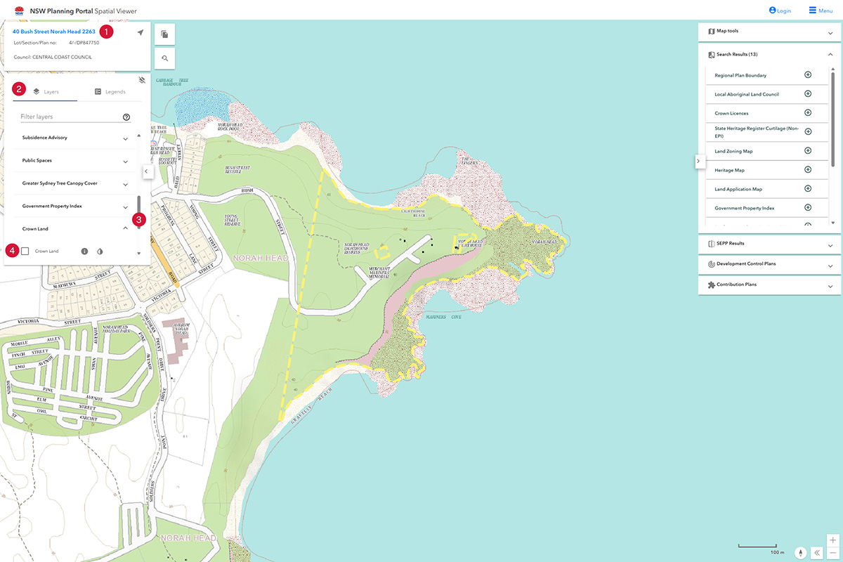
Crown land
- Enter Addressor Lot/DP on left hand side of the page.
- Select Layers tab.
- Select the Crown land layer in the filter layer list (it is at the end of the list).
- Tick Crown land.
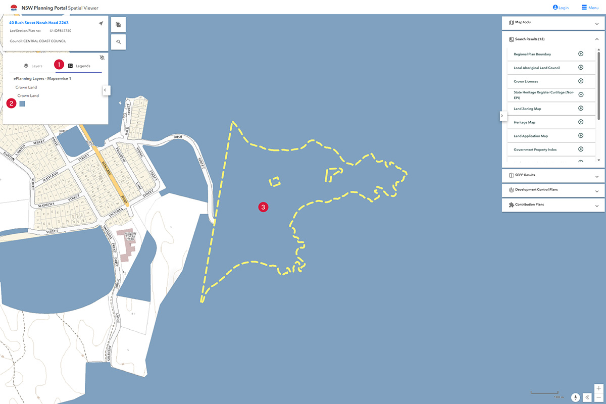
- Select the Legends tab.
- Identify the colour Crown land is to be show on the spatial viewer.
- Point to the location.
- If the colour matches, it's Crown land.
Crown roads
- Enter Address or Lot/DP on left hand side of the page.
- Select the Layers tab.
- Tick the Crown land layer in the filter layer list (it's at the end of the list).
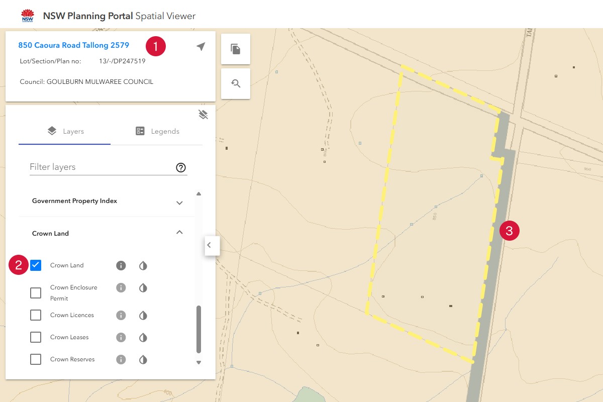
- Select the Legends tab.
- Identify the colour the Crown land is to be shown in the spatial layer.
- Point to the location.
- If the colour matches the legend, it's a Crown road.
Local environment plans
- Select Map tools on the right hand side of the page.
- Select Land Zoning Map.
- Open the zoning listed.
- LEP information displayed.
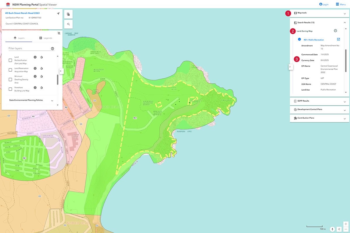
Zoning
- Select Map tools on the right hand side of the page.
- Select Land Zoning Map.
- Zoning information will be displayed.

Property reports
- Enter Address or Lot/DP on left hand side of the page.
- Select the document item to generate a property report.
