New South Wales (NSW) is home to some of the most iconic and diverse spaces in Australia that are reserved for recreational activities such as camping, surfing, hiking and sport.
We manage the state’s parks and reserves, multiple caravan and camping sites, and surfing and dive sites and more with other government agencies and local committees.
For campground registration see Tracks and trails.
Recreation spaces
Our parks and reserves protect unique landscapes around the state. These range from rocky bushland and the natural wonders of the World Heritage Greater Blue Mountains Area to vast recreational parklands on the foreshore and marine wonderlands such as Long Reef and Cabbage Tree Bay Aquatic Reserves off our coastline.
State parks
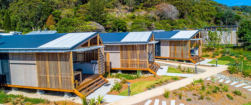
There are 18 state parks in NSW, most of which are located around coastal or inland water and surrounded by bushland.
State parks offer unique visitor experiences, a diverse range of recreation and family friendly facilities and activities, and a chance to reconnect with nature. Accommodation options range from basic to deluxe.
Bellinger Heads – North Coast
With a superb year-round climate; a laidback, humble and relaxed atmosphere; and marvellous beaches, the towns of Urunga and Mylestom are two of the region’s lesser-known jewels.
For more information, visit:
Belmont Wetlands – Hunter Region
Belmont Wetlands State Park comprises 7 coastal wetlands where you can enjoy horse riding, four-wheel driving, walking, swimming and bird watching. The park features the largest single open-water wetland in Lake Macquarie. There are many walking tracks for all levels of fitness. The wetlands are home to numerous bird species, with three bird hides in the southern area of the park, on the Airshaft Peninsula.
Burrinjuck Waters – South-west NSW
Burrinjuck Waters Holiday Park is set on 75 acres on the shores of Lake Burrinjuck and the Murrumbidgee River. It is a great place to go freshwater fishing, water skiing, kayaking and other water adventures. There are some great walks, including the famous Hume and Hovell walking track. Don’t forget tennis and volleyball or frisbee golf and the native wildlife.
Coffs Coast – North Coast
The Coffs Coast State Park is surrounded by beautiful beaches, foreshores, estuaries and wetlands which are perfect for surfing, swimming, diving, fishing and boating. The surrounding area has much to offer, from world heritage rainforests to a marine national park.
Copeton Waters – North Coast
Copeton Holiday and Recreation Park offers a fantastic opportunity to use and enjoy Lake Copeton, an inland water catchment 3 times the capacity of Sydney Harbour. Set on 900 hectares of rural bushland on the western slopes of the New England Ranges, this park offers a unique day trip or holiday experience
Grabine Lakeside – Central West
Grabine Holiday and Recreation Park is located on the banks of Wyangala Dam in Central NSW, which is fed by the Lachlan and Abercrombie Rivers. The dam – 2.5 times the volume of Sydney Harbour – offers 42 km of waterways with boat ramps and access points.
Harrington Beach – North Coast
The Harrington Beach State Park is a 431-hectare site that stretches from Harrington to the picturesque fishing village of Crowdy Head. It features a caravan park, lighthouse and boat harbour. The foreshores of the coastal beaches and estuary provide an array of year-round recreation and tourism opportunities, while the protected tracts of rainforests and other significant native vegetation provide habitat for many species of native animals and plants.
Lake Burrendong – Central West
Lake Burrendong offers year-round attractions for fishing enthusiasts, nature lovers, bushwalkers, campers and picnickers. Located only an hour between Dubbo and Orange, on the western shore of Burrendong Dam, the park is a fantastic base to stay awhile and explore the local area.
Lake Glenbawn – Central West
Set on the banks of Glenbawn Dam in a rural backdrop, the Lake Glenbawn Holiday and Recreation Park offers a wonderful diversity of bushland, wildlife and adventure.
Lake Keepit – Central West
Lake Keepit Holiday and Recreation Park is located about 40 minutes from Tamworth and around 25 minutes from Gunnedah. It is dog friendly, with a lot of space to walk and play with your dog. There is also a water park, skate park and BMX riding. Or you can relax and enjoy the beautiful surrounds. Lake Keepit is ideal for fishing, water sports and other activities.
Living Desert – Far West
Living Desert displays all the breathtaking beauty that the NSW outback has to offer. The 3-hour walk through the park’s winding paths takes you through the stunning sculpture symposium and the plant and animal sanctuary. The cultural walk trail allows visitors to learn about local Aboriginal heritage and the importance of preservation.
Manning Entrance – Mid North Coast
The Manning Entrance State Park is on the NSW Mid North Coast, has a caravan park and basic camping ground. Great for fishing and swimming, there is also a skate park and sports field. Enjoy walking around this area and see the native flora and fauna or visit the historic air strip.
Narrabeen Lagoon State Park – Northern Beaches
The creation of the Narrabeen Lagoon State Park reflects the significance of the lagoon and surrounding public lands to the people of NSW. Enjoy bushwalking and water sports in an area rich with wildlife or take the walking and cycling trail around the entire lagoon.
Wyangala Waters – Central West and Orana
Wyangala Waters Holiday and Recreation Park is located in NSW’s Central West and Orana region, only 30 minutes from Cowra. It is a tranquil place to unwind, set on the banks of scenic Wyangala Dam.
Crown reserves
Crown reserves are land set aside on behalf of the community for a wide range of public purposes including environmental and heritage protection, recreation and sport, open space, community halls, special events and government services.
There is a wide range of tracks and trails across NSW Crown land. Each year hundreds of thousands of walkers enjoy the tracks and trails we manage.
Many of the long-distance trails in NSW crossover into different tenures including Crown Land, National Parks or Forestry. Ensure you check for all track and trail updates before leaving home.
To find out about what’s happening on Crown land, visit Tracks and trails upgrades and development.
Camping on Crown land
Visitors must register to camp on Crown land.
Please complete the camp registration form if you will be camping on NSW Crown land recreational trails. Trails include the:
- Six-Foot Track
- Bridle Track
- Hume and Hovell Track
- Great North Walk
- Clarence Canoe and Kayak Trail.
As part of the NSW Government’s efforts to stop the spread of COVID-19, we ask for your contact details when you camp on Crown land sites.
This information will be used to help track any COVID-19 cases connected to our campgrounds and for no other purpose. We will only give this information to the government as part of a COVID-related request, and it will be kept in accordance with our privacy policy for a minimum of 28 days. This is not a booking form. Camping on these sites is free and we do not take bookings.
This is not a booking form. Camping on these sites is free and we do not take bookings.
Fire Danger
Emergency warning: If extreme or catastrophic fire weather is forecast, or there are existing bushfires in the vicinity, trails will be closed to walkers in these areas.
For more information, visit the Rural Fire Service, National Parks and Wildlife Service or NSW Forestry Corporation.
Maps
There are countless kilometres of walking, riding and paddling tracks and trails and accompanying picnic areas and more to explore in NSW.
To buy map kits for tracks and trails, contact [email protected]. We will establish a new system to allow online ordering of map kits by October 2022. You can also buy maps at local visitor information centres including the Blue Mountains, Yass, Tumut and Wagga Wagga.
Abrahams Bosom Tracks
- Currarong
- Distance/time: 8 km / 1 day
- Grade: Easy
- Activities: Snorkelling, fishing, surfing, walking, running, cycling, dog walking, swimming
Abrahams Bosom Tracks include around 8 km of walking tracks winding around Beecroft Peninsula near Currarong on the NSW south coast. The tracks pass through coastal heath vegetation and along sandstone cliffs with magnificent views up and down the coastline. Only a 35 minute drive from Nowra, the track is accessible to people of all ages and fitness levels, dog owners and bicycle riders, with several spots being ideal for fishing, surfing, picnicking and snorkelling.
The Six Foot Track
- Blue Mountains National Park
- Kanangra-Boyd National Park
- Grade: Hard
- Distance/time: 46 km / 2 to 3 days
The Six Foot Track is currently closed between Jenolan Caves Cottages and Jenolan Caves as a result of works underway at Jenolan Caves.
Jenolan Caves are being revitalised; infrastructure will be renewed and upgraded. For project information, visit the Jenolan Caves website.
Jenolan Caves Road, south of Jenolan Caves Cottages, is also closed to pedestrians and vehicles. Access to Jenolan Caves is only available by means of the ‘Two Mile’ via Edith Road. For road access information and the latest traffic updates, download the Live Traffic NSW App and visit livetraffic.com or call 13 27 01.
Vehicular access to Jenolan Caves Cottages, where the closure of the Six Foot Track begins, is still available. Visit the National Parks and Wildlife Service website.
The iconic Six Foot Track is a 46 km route following the original horse track from the Explorers Tree, Katoomba, to the Jenolan Caves. The track winds through the Blue Mountains National Park and takes in various landscape and heritage features within the Blue Mountains World Heritage area such as Mount York, Nellies Glen, Megalong Valley and more.
The Hume and Hovell Track
- Yass to Albury
- Distance/time: 416 km / 24 days, shorter walks and various day walks available
- Grade: Hard
- Activities: Running, hiking, trekking, walking, camping, fishing, swimming, sailing, boating, water-skiing, cycling
The Hume and Hovell Track stretches over 416 km between Cooma Cottage, Yass and the Hovell Tree on the banks of the Murray River in Albury, passing through the town of Wee Jasper and near the towns of Tumut, Talbingo and Tumbarumba.
There are 3 tracks which are approximately 100 km apart and suitable for car-based camping:
- James Fitzpatrick at Wee Jasper
- Thomas Boyd on the Goobarragandra River, 23 km from Tumut
- Henry Angel on Burra Creek near Tumbarumba
The Great North Walk
- Sydney to Newcastle
- Distance/time: 250 km / 14 days, shorter walks and various day walks available
- Grade: Hard
- Activities: Hiking, running, trekking, walking, camping, cycling, fishing, surfing, dog-walking, swimming
Initially constructed as a celebration of the bicentenary of European settlement in Australia in 1988, The Great North Walk provides many different entry points. It has approximately 100 km of linked tracks that connect the walk to the Pokolbin vineyards and the Sydney–Newcastle bus and railway lines.
The Wiradjuri Walking Track
- Wagga Wagga
- Distance/time: 42 km /1 to 2 days
- Grade: Easy to moderate
- Activities: Walking, cycling, fishing, dog walking, swimming
The Wiradjuri Walking Track follows a 42 km trail around the city of Wagga Wagga. It starts from the Wagga Wagga Visitor Information Centre, along the Murrumbidgee River to the Railway Viaduct, through town looping around Lake Albert, Murrambidya Wetlands and back along the river to return to the centre.
The Bicentennial National Trail
- Cooktown, Queensland to Healesville, Victoria
- Distance/time: 5,330 km / 6 to 7 months minimum
- Grade: Challenging
- Activities: Walking, trekking, cycling, horse riding
The Bicentennial National Trail follows the designated travelling stock reserves (TSR) in NSW, passing through some of the Gondwana Rainforests of Australia World Heritage Area and various Crown reserves, state forests and national parks.
Fivebough Wetlands Loop
- Leeton
- Distance/time: 5 km / 2 hours
- Grade: Easy
- Activities: Walking, bird watching
The Fivebough Wetlands Loop takes in the internationally listed Ramsar Fivebough Wetlands, 2 km from Leeton NSW. The walk begins and ends at the Badyaan Baamira Information Centre and winds around the main basin of the wetlands. There are benches and bird viewing shelters along the way.
Bridle Track
- Bathurst to Hill End
- Distance/time: 70 km / 1 day
- Grade: Moderate
- Activities: Walking, horse riding, cycling, four-wheel driving, fishing, camping, swimming, dog walking
The Bridle Track is a 70 km, 4WD trail from Bathurst to Hill End, following the course of the Macquarie and Turon Rivers. It is currently blocked at Monahan’s Bluff.
Silverton Cycleway
- Silverton
- Distance/time: 8 km / half day
- Grade: Easy
- Activities: Walking, cycling
The Silverton Cycleway first stage is an 8 km section within the Silverton Common. Eventually the cycleway will be a 23 km elevated recreational cycleway following the former Silverton Tramway from Silverton to Broken Hill.
Nail Can Hill Trail
- Albury
- Distance/time: 11.3 km / 1 day
- Grade: Moderate to hard
- Activities: Walking, cycling, running, hiking
The Nail Can Hill Trail Complex comprises a series of mountain bike trails that are looked after by Albury Wodonga Mountain Bikers.
Bundian Way
- Distance/time: 265 km
- Grade: Moderate to hard
Bundian Way is an ancient Aboriginal pathway from Mt Kosciuszko to the coast that has reopened as an Aboriginal-managed cultural tourism experience. For maps, reports and background, visit the Bundian Way.
There are over 260 caravan parks, camping areas and tourist accommodation sites located on some of the most beautiful Crown land.
We have redesigned the Caravan and Camping on Crown Land NSW website. A range of caravan and camping sites on Crown land are at your fingertips on a modern, accessible and mobile-friendly website.
The website showcases accommodation facilities available on Crown land and includes an interactive map for tourists to search for parks across NSW.
These caravan and camping sites give you the opportunity to stay in a wide range of diverse and unique environments, from the beach, the mountains, to the outback.
Visit the new Caravan and Camping on Crown Land NSW website.
The ex-HMAS Adelaide dive site is located approximately 1.8 km off Avoca Beach, near Terrigal on the Central Coast. It is an ideal place for experienced divers.
Before diving on the site, you will need to apply for an entry permit and book a mooring.
To find out more and make a booking, please visit: Ex-HMAS Adelaide dive site
Surfing reserves are areas protected for use by the general public and surfing community. These sites have an environmental, cultural or historical significance in Australian surf culture. This recognition also helps raise awareness about the importance of protecting our precious coastal environment.
We've partnered with the National Surfing Reserves (NSR) Organisation to make sure the sites are protected for generations to come.
There are 24 protected sites along Australia's 37,000 km of coastline. Some of the most popular sites in NSW include:
- Angourie National Surfing Reserve, on the north coast near Yamba, was the first legally protected National Surfing Reserve in NSW. Angourie is legendary among the surfing community for its breaks and natural beauty.
- Crescent Head National Surfing Reserve stretches across 3.5 km of spectacular coastline north of Port Macquarie. Crescent Head became a well-worn trail for surfers following World War II and is known as a breeding ground for longboard surfing in Australia.
- Lennox National Surfing Reserve is just north of Ballina on the north coast and includes the world-famous Lennox Point. The breaks at Lennox have been surfed by thousands of people since the late 1950s, when surfing gained popularity throughout NSW.
- Cronulla Beaches National Surfing Reserve is one of southern Sydney’s premier surf spots. It’s home to a number of former world champion surfers, as well as other influential figures in Australian surfing.
- Merewether Beaches National Surfing Reserve is one of Newcastle's iconic surfing beaches. The 2 km of spectacular coastline stretch from Dixon Park in the north to Burwood Beach in the south.
- Killalea National Surfing Reserve covers The Farm and Mystics beaches within the Killalea State Park, near Shellharbour on the south coast. The state park is 250 hectares and includes some of the best surfing beaches on this coast.
- North Narrabeen National Surfing Reserve is a popular surfing beach on Sydney's northern coastline. The 1-km shoreline includes part of the Narrabeen Lagoon, which plays a role in the natural process of the unique breaks.
For more than 180 years, lighthouses have served an important purpose in providing safe maritime navigation along the NSW coastline, warning ships of headlands, bars and reefs.
During the 19th century, trade via shipping was an essential part of establishing early European settlers in Australia. Shipwrecks became a frequent event in some dangerous coastal locations. To address this, colonial authorities began to build lighthouses along the coastline. Many of these lighthouses remain functional and continue to provide safe navigation to ships, despite significant advancements in technology.
Because of their historical significance, location and architectural values, the lighthouses are also tourist attractions. Our role is to maintain the lighthouse lands and buildings. NSW Roads and Maritime Services maintain the lights to ensure the safety of our boating community.
We manage 14 lighthouses across the state:
- Burrewarra Point Lighthouse
- Warden Head Lighthouse
- Crookhaven Heads Lighthouse
- Kiama Lighthouse
- Wollongong Breakwater Lighthouse
- Wollongong Head Lighthouse
- Norah Head Lighthouse
- Nobbys Head Lighthouse
- Crowdy Head Lighthouse
- Tacking Point Lighthouse
- Clarence River Lighthouse
- Evans Head Beacon
- Richmond River Lighthouse
- Fingal Head Lighthouse
For more information on lighthouses in NSW, visit Roads and Maritime Services.
Across the state, water is held in many hundreds of dams for a variety of purposes including major irrigation, agriculture, domestic supply and public recreation. Storages can also provide a valuable resource during flood times by holding back water, delaying and reducing flood peaks downstream.
We are responsible for a number of small dams across NSW. These include Bethungra, Bargo and De Burgh in the south of the state, West Gosford on the Central Coast, Burraga, Gallymont and Junction Reefs in the central west and Moore Creek and Sheba dams in the north west.